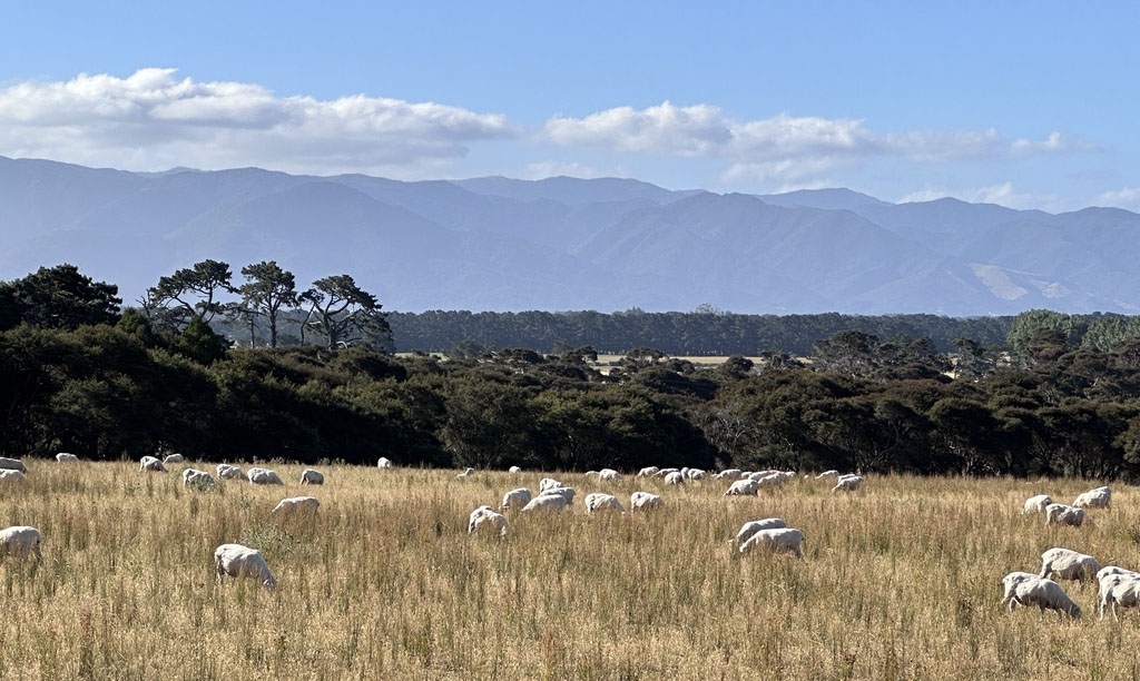
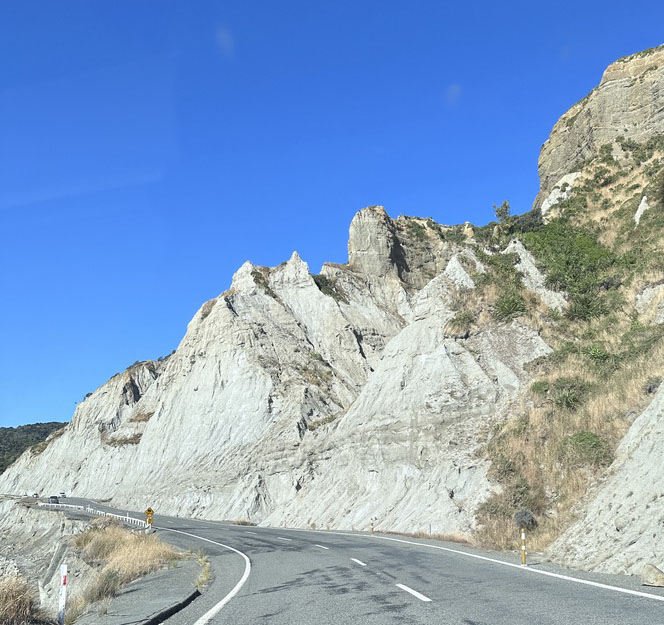
There is a large geographic region area to the east of Wellington known as The Wairarapa. I am not sure why it is The Wairarapa, but that is what they say. It is a rural area with lots of vineyards, cattle, and sheep. With no cities and a sparse population, a dark sky reserve has been established there. There is also an area known as The Pinnacles, with eroded canyons much like the Badlands of South Dakota. But while the Badlands are eroded into soft rolling hills, with deep channels, the Pinnacles have eroded into large pillars more reminiscent of Bryce Canyon. We decided to take a joy ride.
Unfortunately, a rock slide has rendered the trail to the The Pinnacles impassable. Although we did get some sense of it just from the eroding hills next to the road.
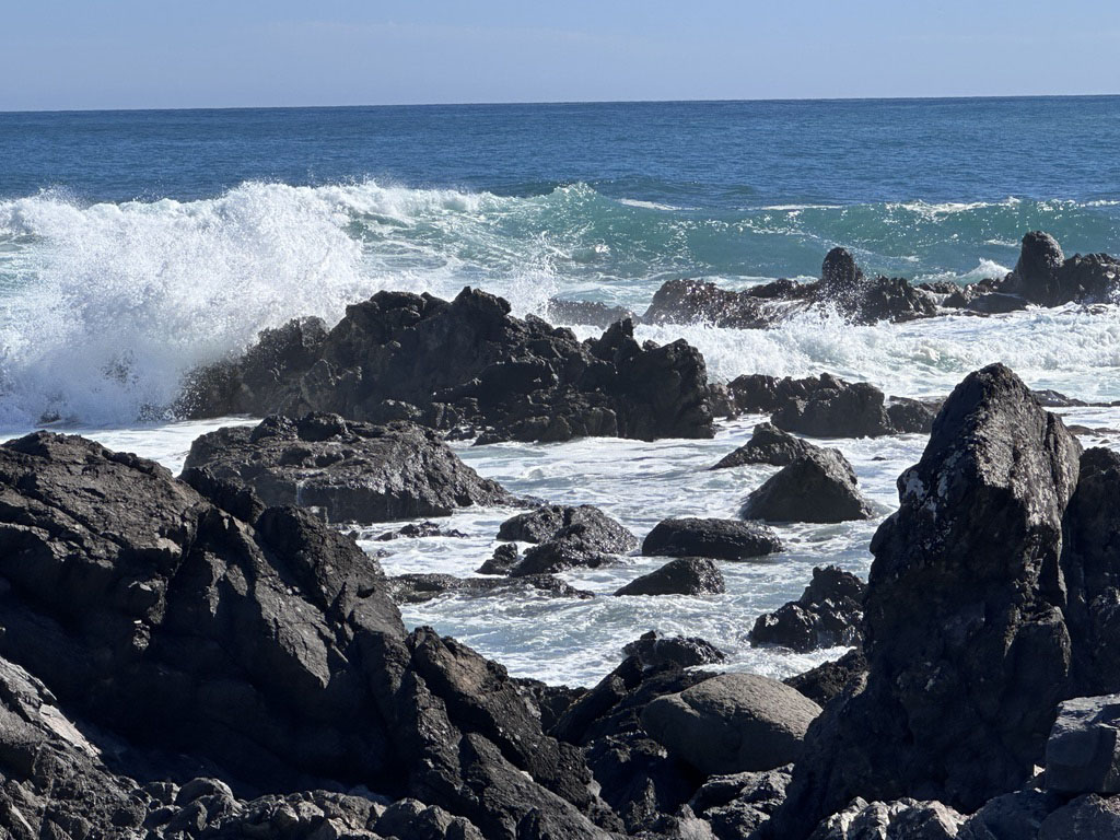
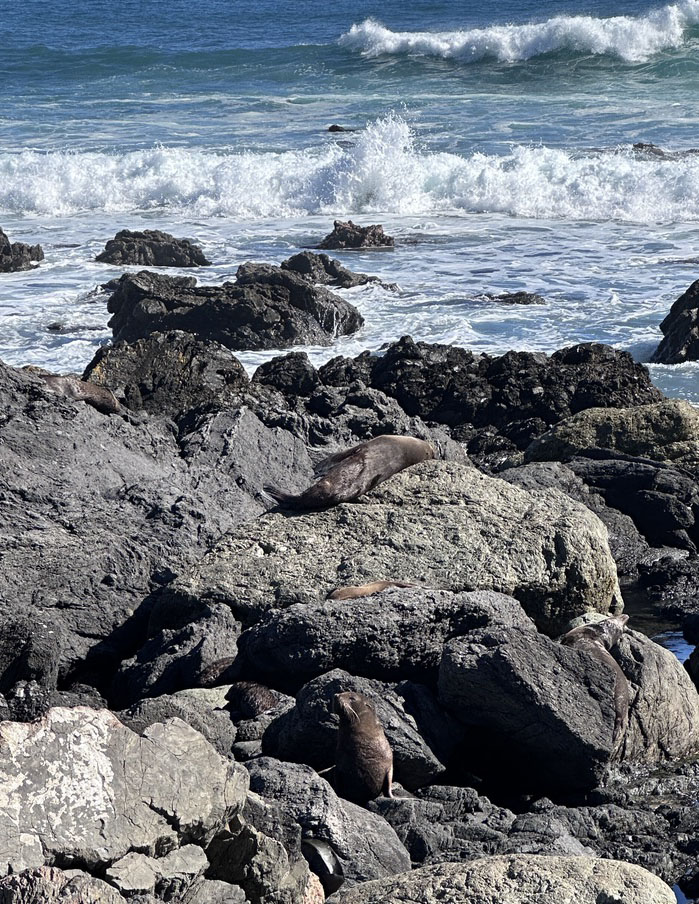
Since we had driven all that way, we decided to keep going to Cape Palliser on the southern tip of the North Island with a working light house and a lot of fur seals. This is the southern most point on the North Island.
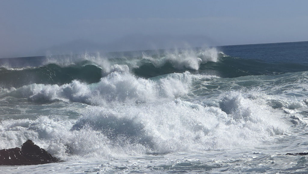
This coast is directly exposed to the South Pacific, which means spectacular views of large waves and rock formations. The road was so close to the sea that in some areas, the road had collapsed. At the Cape, we found clear blue waves rolling along the shore while seals sunned themselves on the rocks.
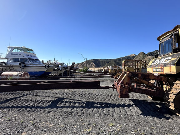
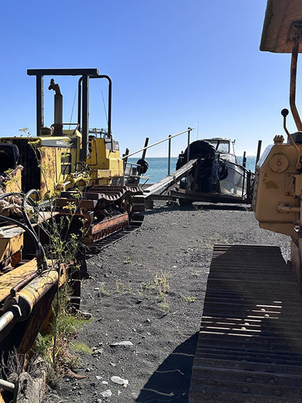
Here is a fun fact–because the New Zealand coast is so rough and exposed, there are few harbors or marinas or even boat ramps on the coast. Instead, boat owners use tractors to launch their boats from the beach. Here at Te Horo Beach it is not unusual to see a tractor drive down the road towing a boat and off to the beach they go.
On this trip, we saw an entire boat yard of boats and tractors in a small town on the way to the cape. I assume that because this is a fairly rural country, the choice of a tractor was obvious. In many towns there is a community tractor that anyone can use. Maybe this is done in other places but I have only seen it here and I think it is pretty interesting no matter where it is done.